"Informed AI News" is an publications aggregation platform, ensuring you only gain the most valuable information, to eliminate information asymmetry and break through the limits of information cocoons. Find out more >>
Hurricane Milton Strikes Florida: NASA's Satellite Data and Disaster Response
- summary
- score
On October 9, 2024, Hurricane Milton, a Category 3 storm, hit Florida, bringing heavy rain and strong winds. NASA and other agencies monitored the hurricane using infrared satellite data, which showed varying intensity as it moved.
The storm formed as a Category 5 near the Yucatán Peninsula and maintained hurricane strength as it crossed the Gulf of Mexico, Florida, and into the western Atlantic. Milton weakened from a Category 4 to a Category 3 before making landfall near Tampa, then downgraded to a Category 1 as it exited Florida.
NASA's Disaster Response Coordination System (DRCS) was activated to assist FEMA and other agencies. MODIS and VIIRS instruments on NASA and NOAA satellites provided data, distinguishing between cold clouds and warm ground through infrared signals.
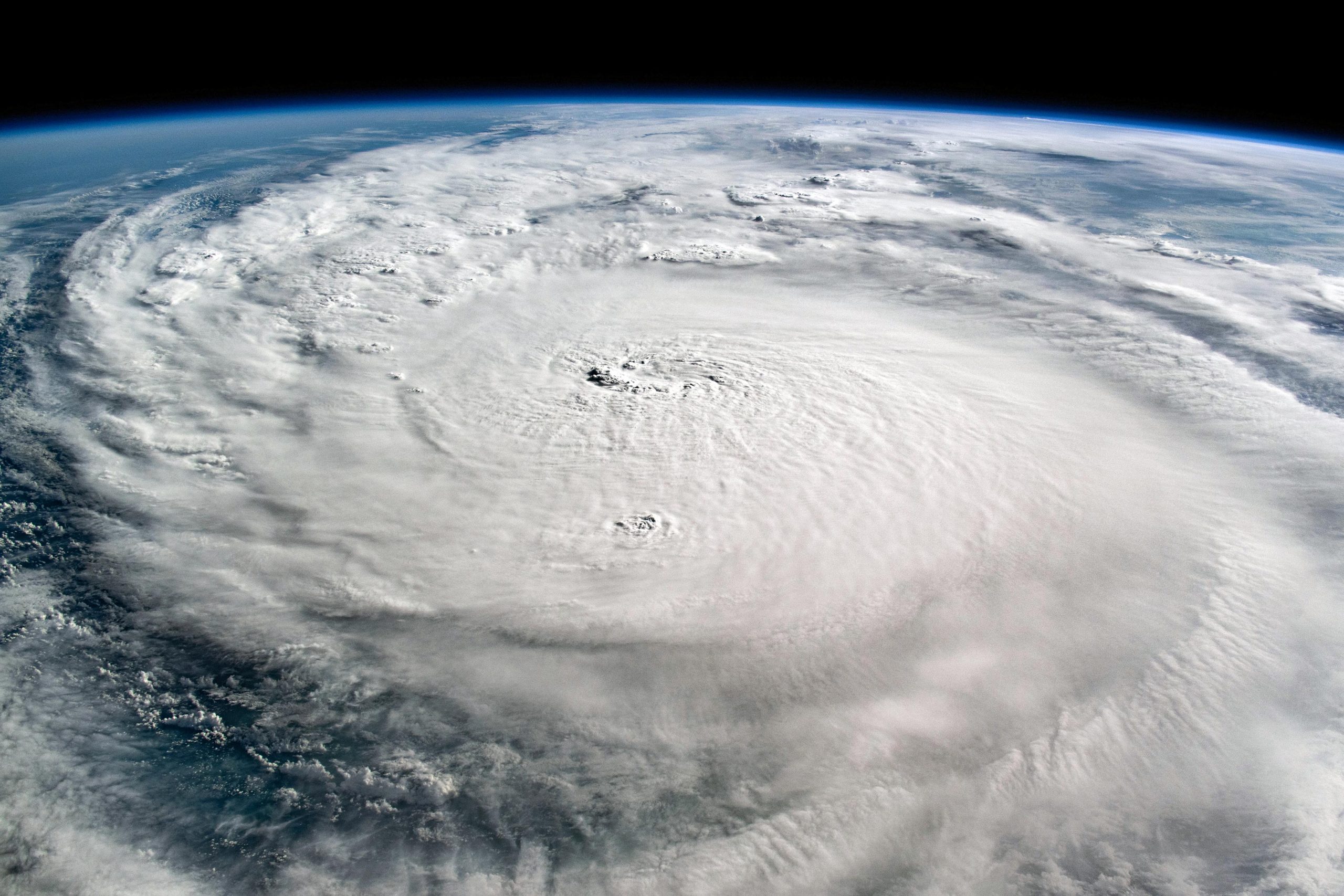
An astronaut on the International Space Station captured images of Milton as a Category 4 storm over the Gulf of Mexico. These images, processed through the International Disaster Charter and NASA's DRCS, are being used to support disaster response efforts.
Key Terms:
- MODIS (Moderate Resolution Imaging Spectroradiometer): A satellite instrument that collects data for various Earth science studies.
- VIIRS (Visible Infrared Imaging Radiometer Suite): A satellite instrument that measures land, atmosphere, and ocean characteristics.
- DRCS (Disaster Response Coordination System): A NASA system that coordinates data and resources for disaster response.
- FEMA (Federal Emergency Management Agency): The U.S. agency responsible for coordinating disaster response and recovery.
| Scores | Value | Explanation |
|---|---|---|
| Objectivity | 6 | Comprehensive reporting with in-depth analysis. |
| Social Impact | 5 | Widespread discussion, significant public opinion influence. |
| Credibility | 6 | Credible, verified by multiple authoritative sources. |
| Potential | 5 | High potential to trigger larger disaster response events. |
| Practicality | 5 | Extremely practical, widely applied in disaster response. |
| Entertainment Value | 2 | Slightly monotonous, few entertaining elements. |